-
Detail
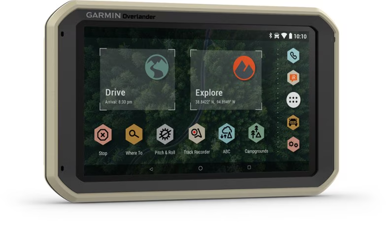
- 7 in. color touch screen features turn-by-turn directions for on-road navigation and topographic maps for off-road guidance covering North and South America
- Topographic maps indicate public land boundaries and 4x4 roads
- Use the Garmin Explore? app to download additional maps and USGS quad sheets on 64 GB of internal storage, and wirelessly sync data between devices (Wi-Fi connection required)
- Preloaded with iOverlander? points of interest (POIs) and Ultimate Public Campgrounds app so you can easily locate your next campsite without a cell signal
- Customize routing for the size and weight of your vehicle and get alerts for upcoming bridge heights, weight limits, sharp curves, steep grades and more
- Integrated pitch and roll gauges help you and your vehicle navigate difficult terrain
- Can be mounted anywhere, thanks to a powered magnetic mount; also includes a suction cup and 1 in. RAM ball Ccompatible adapter
- Pairs with inReach satellite communicators (not included) for 2-way text messaging, interactive SOS and weather forecasts (active subscription required for inReach device)
- Pairs with up to 4 BC? 35 backup cameras (not included) so you can see what's behind you
- GPS, GLONASS and Galileo support helps track in more challenging environments than GPS alone
Imported.
View all Garmin Car GPSBest Use Multisport
Navigating
Preloaded Map Road / Topo
Wireless Communication Yes
Text To Speech Yes
Custom Points of Interest Yes
Lane Assist Yes
OS Compatibility Windows / Mac
Android
iOS
Display Size 7 inches
Screen Pixels 1024 x 600
Touch Screen Yes
Visual Map Display Yes
Color Screen Yes
Number of Routes 250
Number of Waypoints 10,000
Internal Memory 64 gigabytes
Expandable Memory Yes
Compass Yes
Altimeter Pressure-based
Quad Helix Antenna Yes
Compact Antenna Yes
Position Accuracy 3 meters
Battery Type Lithium Ion
Batteries Rechargeable lithium-ion
Average Battery Life Up to 3 hours
Dimensions 7.84 x 4.79 x 0.93 inches
Weight 15.4 ounces
-
Customer ReviewsNo comments

